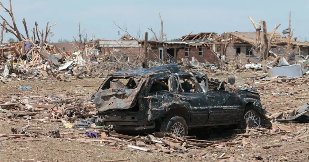
A tornado (also known as a twister), is a rapidly rotating, funnel-shaped cloud that extends from a thunderstorm and comes into contact with the Earth’s surface. These atmospheric storms often contain dust, hail, debris, and water droplets. With wind speeds that can reach up to 300 mph and damage paths that can go over a mile wide and 50 miles long, tornadoes can cause fatalities, injuries, and extensive property damage in a matter of seconds. So how do these unique and powerful storms begin? How does a tornado form?
In this article we’ll explore the environmental conditions that produce tornadoes, discuss their formation, and look at the factors that determine the shape and size a tornado ultimately becomes once it has formed.
Let’s get right into it!
How Does a Tornado Form?
A tornado is formed when:
1. A thunderstorm or hail storm, typically from a cumulonimbus cloud, releases energy and strong winds.
2. Changes in wind direction and intensity at high altitudes cause the air to swirl horizontally, forming a rotating air column (referred to as a mesocyclone).
3. The mesocyclone meets upward moving warm air and the downdraft of cold air, creating a funnel cloud.
4. When the funnel cloud touches the ground, it becomes a tornado.
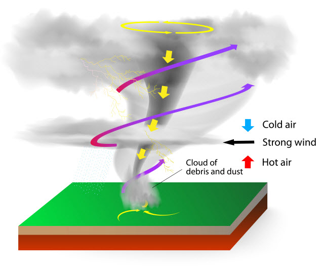
A tornado often spawns from a thunderstorm, but several other conditions in the atmosphere must also be present for a tornado to form.
Other Conditions Necessary for a Tornado to Form
The following 4 conditions cause a thunderstorm to produce a tornado:
- Moisture,
- Lift,
- Instability, and
- Wind Shear.
Moisture
The most fundamental factor that affects severe weather is moisture. Moisture in the air as water vapor creates clouds, precipitation, and storms. Warm water areas often provide an abundant source of water vapor.
In North America and Canada, where tornadoes frequently appear, water vapor can come from the Gulf of Mexico and even as far away as the Caribbean.
| Related Posts |
|---|
Lift
Water vapor (moisture in the air) alone is not enough to produce storms. It requires a lift mechanism to force air to rise in the atmosphere and water vapor to condense into cloud droplets, and eventually precipitation.
Cold fronts, dry lines, strong sea breeze, changes in terrain elevation, and the movement of air masses often provide lift. Gust fronts from thunderstorms are also sources of lift. When air rises, it cools and expands until it reaches the Dew Point Temperature and can no longer hold the water vapor it contains.
Instability
Instability occurs when warm, dense air rises higher in the atmosphere, causing intense updrafts and downdrafts of cold, dry air. The stronger this rapidly rising air becomes, the greater the chances for it to produce thunderstorms, hailstorms, lightning, and tornadoes.
Wind Shear
Wind shear refers to rapid changes in wind speed and direction within a short time or distance. It moves either vertically or horizontally. Powerful amounts of wind shear can cause unfavorable weather, including tornado formation and aviation issues.
Vertical wind shear increases wind speed in height, while horizontal wind shear occurs horizontally and influences directional changes in the wind.
Vertical wind shear is the more common type of wind shear, and it has a stronger impact on wind speed. In a thunderstorm, the vertical wind shear forms when the fast-moving wind moves downward also called a downburst. Once the downburst hits ground level, it spreads in all directions at varying speeds, sometimes reaching up to 100 mph.
Meteorologists look into these different factors in forecasting weather. They also consider atmospheric patterns, the time of the year, and geography. When all these ingredients come together at the right place, and the right time, they might bring in outbreaks of severe weather in the form of thunderstorms and tornadoes.
What Are the Characteristics of a Tornado?
Most people recognize tornadoes for its funnel shape, but they may vary in size, intensity, direction, and appearance.
Below are some of the physical features of a tornado, which include:
- Shape,
- Size,
- Wind Speed,
- Color, and
- Rotation
Let’s take a closer look at each one.
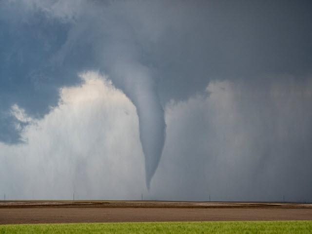
Shape
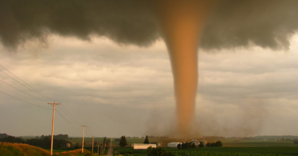
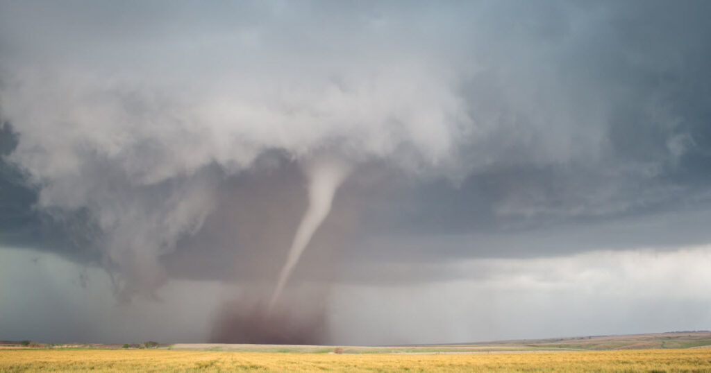
Also called a condensation funnel, the funnel shape of a tornado is a column of water droplets that extend from the parent cloud towards the ground. It often is mixed with dust and debris swept upward from the surface.
Weak tornadoes are usually cone-shaped, while violent ones appear as short, broad, and cylindrical pillars. In their waning stages, tornadoes come in the shape of long, rope-like tubes.
Size
Tornadoes also come in different sizes. However, how large or small a tornado is does not equate to its strength or intensity. Some small tornadoes can cause severe devastation, while the larger ones may only produce weak damage.
The easiest way to assess the size of a tornado is through its damage path. The typical damage path is about one to two miles, but the damage path of the larger tornadoes can reach hundreds of miles.
A tornado’s width also changes during its lifetime. The smallest width can be less than 10 yards, while the largest ones may reach up to two miles wide.
Wind Speed
The Enhanced-Fujita Scale, as summarized in the table below, is a tool meteorologists use to determine a tornado’s wind speed.
| Enhanced Fujita Scale | Enhanced Fujita Scale |
| EF Rating | 3 Second Gust (mph) |
| 0 – Mild Damage | 65 to 85 |
| 1 – Moderate Damage | 86 to 110 |
| 2 – Considerable Damage | 111 to 135 |
| 3 – Severe Damage | 136 to 165 |
| 4 – Extreme Damage | 166 to 200 |
| 5 – Incredible Damage | Over 200 |
Color
If a tornado contains plenty of humid air, it is most likely to look white or dark gray in color. However, tornadoes may also come in shades of black, red, or green. Several factors such as the direction and elevation of the sun, surrounding clouds, and the type of terrain the tornado passes over can affect a tornado’s color. For example, a tornado that courses over a farmland with rich, topsoil may appear black, while one that passes over red clay may have a reddish color.
Rotation
Tornadoes in the northern hemisphere spin counter-clockwise, while in the southern hemisphere, tornadoes spin clockwise.
What are the Types of Tornadoes?
Tornadoes are classified into two main types, supercell and non-supercell tornadoes. Both types of also have sub-types, which are named according to the tornado’s shape or where it comes from.
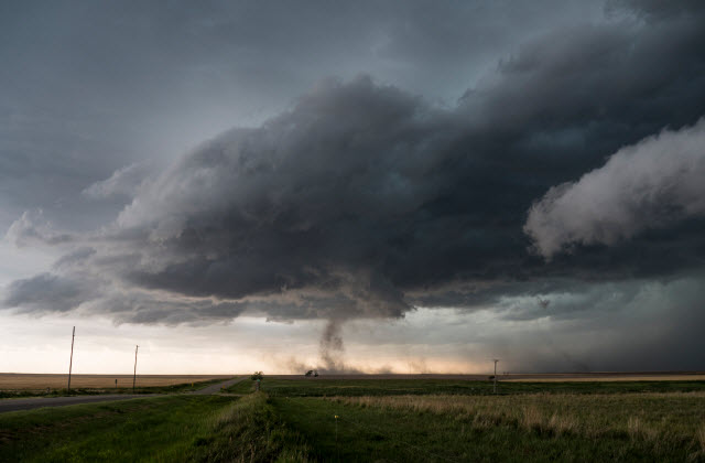
Supercell Tornadoes
Supercell thunderstorms are long-lasting thunderstorms that travel for miles. Besides hail and wind damage, they also spawn tornadoes.
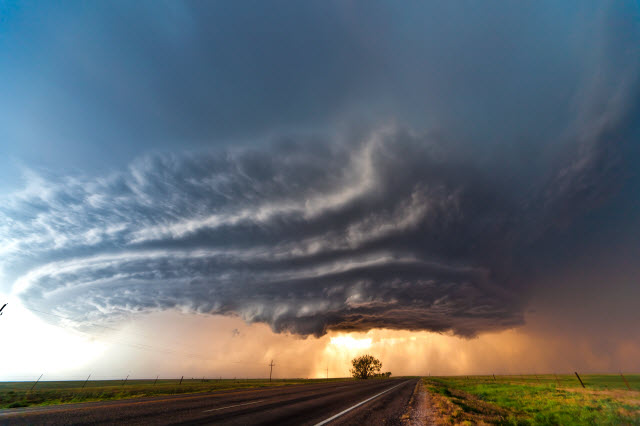
While only 20% of supercell thunderstorms produce tornadoes, they often form the most violent and dangerous ones.
- Wedge Tornadoes – These tornadoes tend to be very destructive, and are often classified as EF3 or higher.
- Rope Tornadoes – They appear slender, but they can develop into larger forms.
- Cone Tornadoes – They are broader near the cloud and narrower as the column reaches the surface.
- Stovepipe Tornadoes – They look similar to cone tornadoes, but they keep a tall and narrow shape from the cloud base to the ground.
- Multi-Vortex Tornadoes – These tornadoes have more than one spinning funnel of air. Typically, the tubes of air or vortices spin around a larger, central vortex.
- Rain-wrapped Tornadoes – They are particularly dangerous because they hide behind intense rainfall. They are less common and can only be detected by radar.
Non-Supercell Tornadoes
These types of tornadoes do not start from storms. Rather they form from a vertical, rotating parcel of air near the ground caused drylines and warm or cold fronts.
- Gustnadoes – Gustnadoes are small, short-lived whirlwinds. They form along the gust front of a storm, have no condensation funnel, and contain dust or debris.
- Landspouts – Landspouts generally have a flat base and fluffy appearance, but some may also appear thin and rope-like. They originate close to the surface and form while the thunderstorm is still growing.
- Waterspouts – These tornadoes are similar to landspouts, but they form over water. Waterspouts typically have an EF2 rating or less.
How Can You Tell if a Tornado is About to Form?
Meteorologists continuously monitor atmospheric changes to determine if potential weather disturbances will occur. If they see the likelihood of a thunderstorm, and eventually the development of tornadoes, they will notify those who may be affected.
- Tornado Watch – This means that weather conditions are favorable to the formation of a tornado and when the possibility of a tornado reaching land is high. It usually encompasses several areas, states, or countries and can last for hours. People should start preparing for a tornado, take shelter, and stay tuned for weather updates.
- Tornado Warning – This means that a tornado is imminent or is happening at the moment. People must take shelter immediately, or stay away from windows, doors, outside walls, and damaged buildings and power lines.
The most obvious indicator that a tornado is coming is when you see a funnel making its way towards the ground.
However, there are other warning signs that tell a tornado is on the horizon. When you see these signs, it is essential to find emergency shelter.
Signs a Tornado May be About to Form
- Dark, greenish or greenish-yellow skies – Clouds with these colors contain hail.
- Hail – Thunderstorms that produce hail are most likely to generate a tornado.
- Debris cloud – Tornadoes sometimes don’t have a funnel, but instead they appear as a whirling cloud of dust and debris.
- Calm after a thunderstorm – Before a tornado strikes, the air can become still, and the wind will die down.
- Continuous, rumbling sound – Tornadoes come with a persistent noise, similar to the sound of a freight train.
Tornadoes can happen anywhere, anytime. Though they may appear more frequently in areas where the weather is conducive, and during the summer or spring season, it is advisable to stay updated on weather reports.